
Use photos to explain the property—not approve it
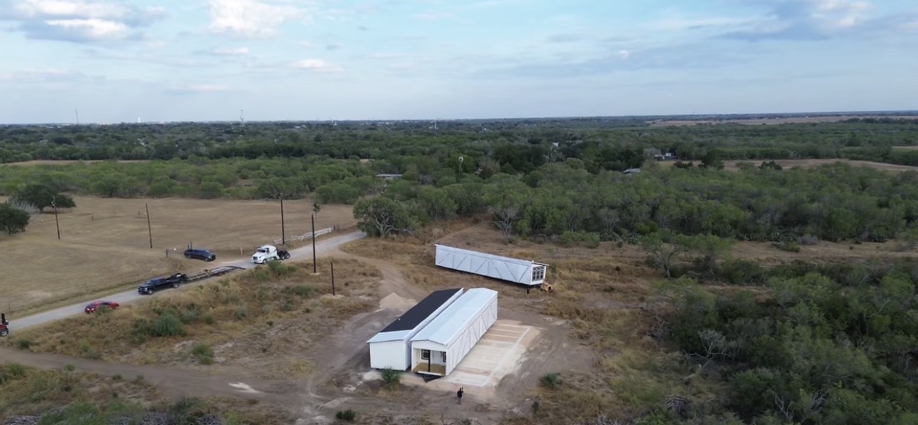
Property photos can make your first conversation with MHC Victoria more specific. They can show what you mean by “narrow entrance,” “existing meter” or “open area behind the house.” They cannot establish that a delivery route works, a utility can serve the home, the proposed location is permitted or the land is ready for installation.
Take photos only from places you can enter safely and with permission. Do not stand in traffic, climb structures, enter utility areas or cross neighboring property for a better angle. If a view is unsafe or unavailable, mark it as missing and ask who should inspect it.
Create one folder named with the property address or parcel reference and the date. Add a short text note identifying the city or county you believe has jurisdiction, but label that information “to confirm” until the appropriate office verifies it.
1. Start at the public road
Take a wide photo showing the property entrance in relation to the road. If it is safe, add views looking along the road in both directions. Record the road name and describe whether the image was taken from the property or another permitted location.
Do not use a photograph to judge whether transportation equipment can enter or turn. Ask who will evaluate the route, what home dimensions they need and whether an on-site review is required.
- Wide view of the entrance and road
- Approach from each direction, only where safe
- Road signs, bridge notices or visible restrictions to ask about
- Unanswered question: who confirms the transport route?
2. Document the entrance and internal route
Photograph the entrance straight on and from inside the property looking back toward the road. Continue along the expected route and photograph turns, gates, fences, trees, overhead lines, ditches, culverts, existing structures and any other visible feature that may need review.
Add measurements only when you can take them safely and accurately. Label exactly what was measured. A gate-opening measurement is not the same as a full transport-clearance review.
Number the images in travel order—01 entrance, 02 first turn, 03 narrow point and so on. That sequence helps a consultant or reviewer understand the route instead of trying to reconstruct it from unrelated pictures.
3. Photograph the proposed homesite from four directions
Stand near the proposed home location and take four wide views facing north, east, south and west if you can identify the directions. Otherwise label them toward road, away from road, left and right. Include nearby structures, large trees, slopes, drainage features and property boundaries only as they are visibly understood.
Add a simple sketch showing the approximate proposed location, entrance, route and nearby features. Mark the sketch “concept only.” Ask which survey, site plan, setback or placement information the reviewing authority requires.
Do not treat an open-looking area as proof that a home can be placed there. The exact home, jurisdiction, floodplain status, site conditions and installation plan need their own reviews.
4. Keep utility photos separated by service
Create separate groups for electricity, water, wastewater and gas if applicable. Photograph only what is safely visible and record the provider or system information you already have. Do not open equipment, enter enclosures or assume a line, meter, well or tank belongs to the property or is usable.
For each service, write the question the photo is meant to explain. Examples include: Which provider serves this parcel? Can the existing service support the proposed home? Where would the responsible contractor's work begin and end? What inspection or connection work is required?
If the property may use an on-site sewage facility, TCEQ directs owners to the local permitting authority and explains that permits and approved plans generally apply to constructing, altering, repairing, extending or operating an OSSF. Bring any existing records, but ask the authority to evaluate the actual proposal rather than assuming an older system can serve a different home.
5. Record water movement without drawing conclusions
Photograph visible ditches, culverts, low areas, erosion, standing water or drainage paths from a safe location. Include the date and recent weather if it helps explain what is visible. Do not alter the site or enter flooded areas to collect a better image.
For property within the City of Victoria, the Development Center coordinates building permits, inspections and floodplain management. The city specifically lists manufactured-home placement among work handled through its permitting resources and advises contacting the Floodplain Administrator about property location and additional floodplain requirements.
Victoria County separately states that permits are required for development in the floodplain under its authority. Confirm the jurisdiction first, then ask the responsible office what maps, elevation information, permits or professional reviews apply to the exact parcel and proposed home.
6. Add documents beside the matching photos
Include property records you already have permission to share, such as a survey, plat, deed exhibit, utility correspondence, prior permits or OSSF documents. Keep sensitive personal information out of the shared packet unless a secure process specifically requires it.
Link each document to the question it may help answer. A survey may help locate boundaries; it does not by itself confirm current zoning, floodplain requirements, utility capacity or approval for the proposed placement.
Finish the packet with an open-item log containing the question, responsible contact, information needed and next action. Use confirmed, proposed and open as the status choices.
7. Test the same property packet against two homes
Choose two model layouts and attach the correct model link to each. Ask what configuration and dimensions should be used for the property conversation. Keep the images and answers connected to the exact home being considered.
Run both homes through the same questions: route, proposed placement, utility plan, wastewater plan, jurisdiction and property-specific review. If an answer changes between the homes, note why and what evidence is still needed.
Ask for any resulting delivery, installation or property work to appear in the written project scope. A photo packet makes the questions easier to see; it does not replace the records, inspections or approvals behind the answers.
Bring the packet to MHC Victoria on US-77
Before traveling to MHC Victoria at 14182 US-77, Victoria, TX 77904, call (361) 333-0616 to confirm visit details and which homes are currently available to tour.
Bring the labeled photo folder, property documents, two model links and the open-item log. Ask the team to identify which questions it can answer, which need a site visit and which belong with a city, county, provider, installer or other qualified professional.
The official resources below were checked October 26, 2026. Requirements and property conditions can change, so confirm current information for the exact parcel and proposed project.